anvaka/map-of-github: Inspirational Mapping
Inspirational Mapping
Inspirational Mapping

Blitzortung.org provides lightning and thunderstorm information in real-time on maps for USA, United Kingdom, Australia, new Zealand, Europa, Africa, Asia and other Countries.
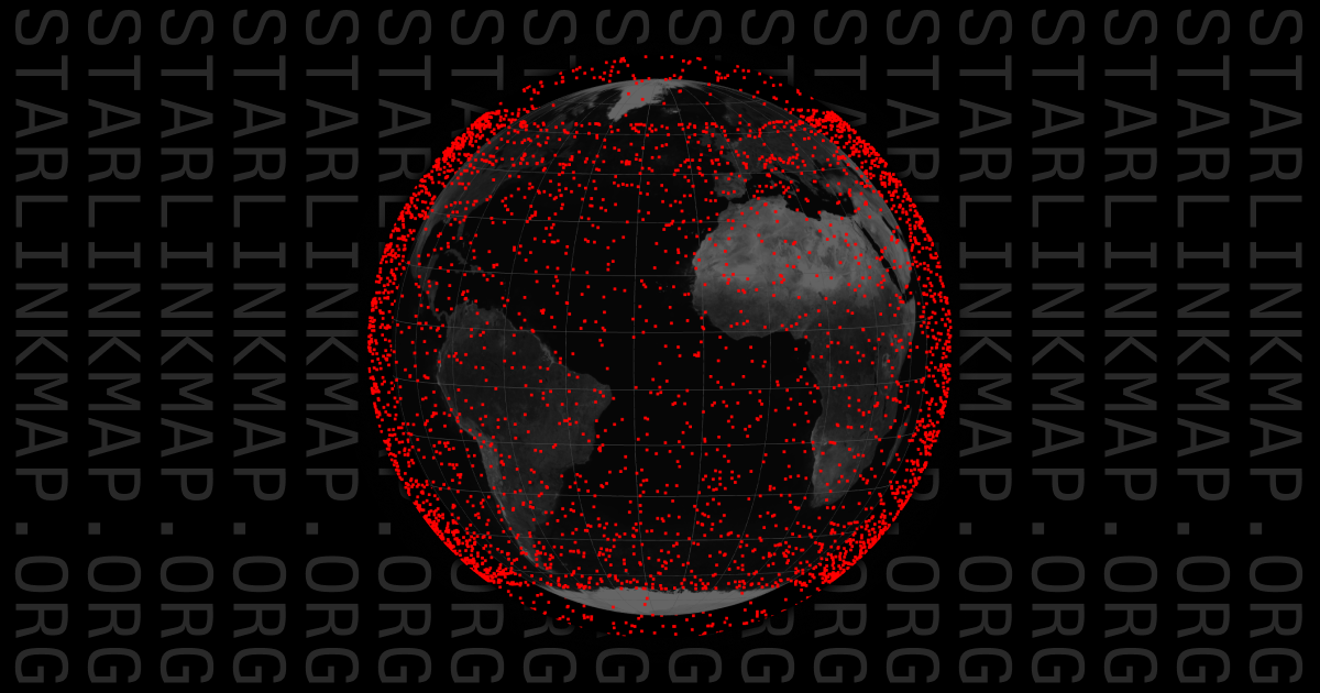
Track the Starlink satellite constellation in real-time.
Der interaktive Dienst UDO (Umwelt-Daten und -Karten Online) ermöglicht den allgemeinen Zugriff auf ausgewählte Umweltdaten und digitale Kartenbestände.
Compare the size of countries, regions and cities.
TeleGeography's comprehensive and regularly updated interactive map of the world's major submarine cable systems and landing stations.
Interactive world light pollution map. The map uses NOAA/EOG VIIRS, World Atlas 2015, Aurora prediction, observatories, clouds and SQM/SQC overlay contributed by users.
VesselFinder is a FREE AIS vessel tracking web site. VesselFinder displays real time ship positions and marine traffic detected by global AIS network.
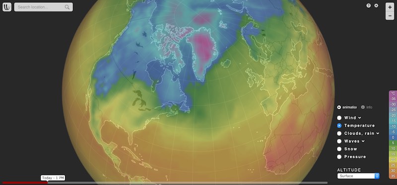
Wind map and weather forecast